On Trail of Vanishing Creek
- Share via
Eagle Lake, a popular weekend backpacker destination, is accessible by one of Mineral King’s easier trails. Relatively easier, that is. A 2,200-foot gain at high altitude in 3 1/2 miles is a good workout to say the least.
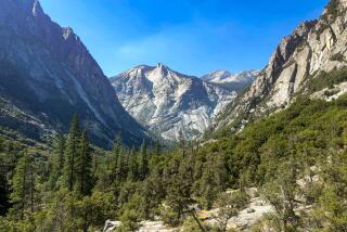
When the light is right, the lake mirrors its scenic surroundings: weathered foxtail pines, polished granite walls, their shaded cracks and crevices, with patches of long-lingering snow.
Eagle, like many Sierra lakes, was “improved” to render it more reservoir-like. Mt. Whitney Power Co. built a rock dam to better control waters flowing to their hydroelectric plant near Three Rivers.
En route to Eagle Lake, you’ll encounter two strange waterways. The path crosses Spring Creek, which emerges as if from nowhere. Geologists speculate that it is of subterranean origin.
If the sudden appearance of Spring Creek isn’t strange enough, Eagle Lake Trail hikers also witness the disappearance of Eagle Creek into a large sinkhole. The creek reappears down the hillside, leading to speculation that it is channeled through a network of underground passageways in the marble rock below ground.
Experienced hikers, familiar with cross-country travel, can make a loop of this hike: Climb a ridge from Eagle Lake then descend into Mosquito Lakes Basin. You’ll arrive at Mosquito Lake No. 4 and follow the lake chain north until you join the Mosquito Lakes Trail that returns you to Mineral King.
Directions to trail head: From California 198, three miles northeast of the town of Three Rivers, turn right (east) on Mineral King Road and drive 25 miles to Cold Springs Campground. Beyond the camp, continue east on Mineral King Road 1 1/2 more miles past the ranger station to the trail head parking area.
Warning: Rangers and hikers report that for reasons unknown local marmots have developed a taste for rubber, and during spring and early summer they sometimes gnaw on vehicle belts and hoses. Pray the critters leave your car alone or park farther down the valley where the marmots are fewer. Then walk up to the trail head. Check your engine before departing.
The hike: The path leads south above the East Fork of the Kaweah River and soon crosses the strange Spring Creek on a wood footbridge. Three-quarters of a mile out, the path crosses Eagle Creek and continues another quarter-mile to a junction with White Chief Trail.
Stay right, tackling steep switchbacks that climb half a mile over a fir-clad mountainside. Observe Eagle Creek’s disappearing act, then continue across a meadow to the junction with Mosquito Lakes Trail, two miles out.
Continue southwest toward Eagle Lake. Staying west of Eagle Creek, the trail switchbacks steeply, climbing white granite slopes and finally reaching the outlet of Eagle Lake.
(BEGIN TEXT OF INFOBOX / INFOGRAPHIC)
Eagle Lake Trail
WHERE: Sequoia National Park
DISTANCE: 7 miles round trip with 2,200-foot elevation gain.
TERRAIN: Fir forest, granite slopes.
HIGHLIGHTS: “Disappearing” Eagle Creek; scenic Eagle Lake.
DEGREE OF DIFFICULTY: Strenuous.
PRECAUTIONS: Marauding marmots gnaw rubber auto parts.
FOR MORE INFORMATION: Sequoia National Park, Three Rivers, CA 93271; tel. (209) 565-3341.
More to Read
Sign up for The Wild
We’ll help you find the best places to hike, bike and run, as well as the perfect silent spots for meditation and yoga.
You may occasionally receive promotional content from the Los Angeles Times.


